Showing posts with label Lake Champlain. Show all posts

Saturday, September 8, 2012

Split Rock on Lake Champlain and the Treaty of Utrecht

In the colonial period, the border between the French colony of Québec and the English colony of New York was not clearly established.  Until the end of the French and Indian war, it was quite fluid.  Each colonial power tried to maintain a presence or "outpost" to intimidate and control the other. Hostile expeditions on the frontier or borderlands was ever ongoing: Champlain attacked Iroquois villages in the Mohawk Valley in 1615. The French Carignan Salieres regiments made expeditions as far as Schenectady in 1666.  In retaliation for the English colony's massacre at LaChine, Québec, French marines and allies attacked Schenectady in  1690. 


Then came the Treaty of Utrecht supposedly.....


At the dawn of the 18th century, European countries and dominions fought the War of Spanish Succession because they feared France and Spain might unite under Philippe IV to form one country much too powerful.  The war was also fought on three fronts in North America: Spanish  Florida and the English colony of Carolina,  the Atlantic Provinces of present day Canada AND  in the land now called New York, New England and Québec.  Indigenous peoples often fought the battles serving as proxies for the European powers.  When it was finished, all parties except the indigenous peoples signed a treaty together often called 'The Treaty of Utrecht".

Historians of the North America colonial period usually discuss the impact of the terms of the treaty in regards to Acadia, Newfoundland, Hudson Bay and the Caribbean.  Probably because the treaty is quite specific about the terms impacting these commercially rich areas.  Here's a quote from a Wikipedia:

"In 1712, Britain and France declared an armistice, and a final peace agreement was signed the following year. Under terms of the 1713Treaty of Utrecht, Britain gained Acadia (which they renamed Nova Scotia), sovereignty over Newfoundland, the Hudson Bay region, and the Caribbean island of St. Kitts. France recognized British suzerainty over the Iroquois, and agreed that commerce with Native Americans further inland would be open to all nations. It retained all of the islands in the Gulf of Saint Lawrence, including Cape Breton Island, and retained fishing rights in the area, including rights to dry fish on the northern shore of Newfoundland."
Accessed form Wikipedia on September 9th, 2012 http://en.wikipedia.org/wiki/Queen_Anne%27s_War#cite_ref-Prowse223_27-0

The treaty does not have a specific item identifying the borderlands between Québec, New York and the New England  colonies.  As I read the English version of the treaty,  it would appear to postpone settling a border.  After describing the agreement regarding Hudson Bay, the last line of item IX states "The same commissaries shall also have orders to describe and settle, in like manner, the boundaries between the other British and French colonies in these parts."

Here is the English section IX of the treaty:

Add caption

and the French wording:


Of course, to the indigenous people, the total concept of a treaty written and signed in Holland to parcel up their lands and give certain entitlements to other powers must have been a gruel joke.

New York State history books usually state that the Treaty of Utrecht established a border south of which the French were not to settle and this borderline was known to be "Split Rock" on the western shores of Lake Champlain.  I cannot find that particular wording in the treaty.  I wonder if the French couldn't find it either.  It seems that the French had a vastly different interpretation of the terms because they later settled 25 miles south of Split Rock at Fort St Frederic (present day Crown Point, NY)  - 25 miles south. Then they built Fort Carillon (present day Ticonderoga) 16 miles south of St Frederic!!!


Until I can find the original source where Split Rock was designated the mark, I will continue to go with the New York State history books.  If anyone reading this can point me to the primary source and lines in the Treaty of Utrecht, I would be immensely grateful!  Thank you.

Monday, March 12, 2012

Mapping the Route: Québec to Waterford, NY

A Different Route; a Different Livelihood 
While Solyme Beauvais was making his way to the industrial city of Cohoes in the 1860s via the Central Vermont Railroad, the Rutland Railroad, Troy Salem and Rensselaer Rail, the Poissant-Glode Family took a very different route.  This family "eased" across the northern border from Québec into Clinton County, first as farmers and but eventually as Champlain canalers.  For several generations the physical border was as fluid as the waters of the lakes and rivers they navigated.
This was not the typical French Canadian immigrant family who came to work in textile mills of New York or New England.

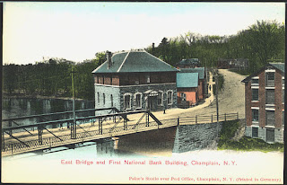
According to census information, Luc Glode was probably born in Clinton County in 1837.  The earliest census where his father, Jacob-Jacques Glode, appears is in the 1850 census of Champlain.  There, his name is spelled Jocks Glade.  Jacques was the great great grandson of Jacques Poissant dit LaSaline, a Huguenot and Sargent in the Franche Marine company of de Noyan.  John Fisher has detailed the early Poissant family in France and Québec here.

 Descendants of Poissant dit LaSaline's son Claude used "Claude" as a "dit name" eventually dropping the Poissant and keeping the Claude. The Claude name morphed into Glaude, Glade and Glode. 


The 1850 census heading in Champlain, Clinton County, New York:


Jocks and his six children - with very misspelled names!


Jacques Jacob, was a famer and laborer but his son Luc Glode became a canalman and "straddled" the border navigating Lake Champlain and the Richelieu. In the 1860 US census he is living in Champlain, Clinton County, NY. with wife and first child.  HOWEVER,  in the 1901 Canada census he can be found in St. Jean/Iberville, Québec!!  

Luc Glode probably grew up in and around the town of Champlain, NY.

Luc Glode likely spent his years navigating the Chazy River ..


and Lake Champlain.....


 and the Richelieu River....


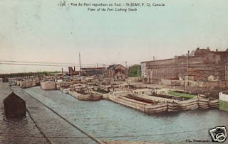
He knew St Jean sur Richelieu....

 and probably the port of Montréal too.

Saturday, March 10, 2012


It has been several months since I have been up north near the lake of my ancestors.  Working in New York City this winter has made me a little lonesome for the vast spaces and hills around Lake Champlain.


So I am dreaming of a weekend in spring when I can make a short trip along the west side of the lake - to Clinton and Essex Counties in upstate New York! 


Tuesday, March 29, 2011

Images of Crown Point on Lake Champlain circa 1900

Dorothy Wills Mylott, who lived most of her life in the Hudson-Mohawk Industrial area, bought these photographs of Crown Point at an auction in 1990.  I wonder if she realized Crown Point was a central place in her family's history.  Her French Canadian ancestor, Joseph Payant sailed Lake Champlain from Fort St Frederic (later known as Crown Point) to Ile aux Noix.  Her French Canadian grandfather, Jacques Beauvais, fought in the Seven Years War to keep it in the French domain. Her Cornish grandfather worked many years in the mines of Port Henry over in the hills beyond the lake shore. 


Thursday, March 10, 2011

Cat and Mouse on Lake Champlain: "Admiral" Joseph Payant dit Saintonge & his role in the French and Indian War

Early 20th century postcard of Fort Lennox
Present Day site of Fort Lennox on Ile aux Noix
Parks Canada


Joseph Payant dit St Onge is called the Admiral of Lake Champlain  (L'Admiral du Lac Champlain) and he is a direct ancestor of many in Canada and the USA, including the Wills-Beauvais family of this blog.  If a Bissonnette/Bisnett of Cohoes was your grandparent, great grandparent, etc  (Joseph, Alfred, Elizabeth) then you are a descendant of Joseph Payant.  Thousands of people can claim "Admiral Joe" their ancestor!


Our line (Wills) is simply this:

  • Nine (9) Wills children (Celena, Julia, Anna, Johnny, Elizabeth, Dorothy, Etta, Larry, Robert) whose mother was
  • Elizabeth Bissonnette (1880-1936) who married John Wills, and was the daughter of
  • Celena Beauvais (1850-1942), the daughter
  • Adele Guais dit Castonguais (abt 1824-?), the daughter of
  • Marie Angelique Delmas (1792-1855), the daughter of
  • Marie Louise Allaire (1768-?), the daughter of
  • Marie Louise Payant dit St Onge (1747-?), daughter of
  • Dominique Payant (1724- 1778), son of
  • Joseph Payant dit St Onge (1700-1783), the "Admiral of Lake Champlain"


The early 20th century entrance to Fort Lennox

To understand the role of Joseph Payant on Lake Champlain and also in the French and Indian War, it's necessary to know about his background. He was born in Québec City in 1700. His mother died when he was ten years old but his father, a shoemaker, quickly remarried. Joseph was not left motherless. As a young man he learned to pilot and navigate on the St Lawrence River.  Married at 21,  he had a wife, family, home on Rue St Flavian in Québec and a blacksmith shop where he worked in winters.  In spring when the ice on the river opened up, Joseph kissed his wife and children "adieu" was off to the Champlain Valley where he piloted ships along the Richelieu and Champlain: Fort Frederic, Ile aux Noix, Fort Chambly and probably Fort Carillon too. The ships, built in St Jean, carried troops and supplies from Montreal and Chambly to the forts south and back again. When the Swedish naturalist, Pehr Kalm, traveled in Lake Champlain region, it was  Joseph Payant who escorted him.  It is said Joseph transported General Montcalm from Carillon to points north after Montcalm's victory becoming well acquainted.  Later, one of Joseph's grandsons was named Montcalm in honor of the general.  Dominique, Joseph's son and our ancestor, was listed as a sailor with his father on Lake Champlain and married Marie Louise Laporte in St Joseph's Church in Chambly.  Their marriage contract stated Dominique owned land on Lake Champlain in the area across from Ile aux Noix close to where Lake Champlain enters the Richelieu River.

In the midst of the French and Indian War, after the French abandoned Fort Frederic to the English, Joseph Payant continued to pilot a schooner with eight cannons named La Vigilante on the waters of Champlain.   Payant was not the commander of the French fleet on the lake, that honor was held by Joannis-Galand d'Olabaratz, a commissioned naval officer. The English fleet was commanded by Captain Joshua Loring.  For several weeks that autumn, while Amherst was rebuilding and enlarging the  fort at Crown Point the English and French fleets played deadly serious games of chase on the lake.

Russel Bellico on page 100 of Sails and Steam in the Mountains (revised edition 2001: Purple Mountain Press) writes about a particular event on October 12th, 1759...
"On the first night, Loring with the brig and sloop had sailed past the three French sloops at Four Brothers Islands, commanded by Joannis Galand d'Olabaratz. The schooner La Vigilante , commanded by Joseph Payant St. Onge, was stationed further north on the lake near Grand Isle.  At daybreak on October 12th, Loring observed the French schooner apparently moving toward the two British ships.  The Vigilante fired and the Cumberland and Boscawen (the English boats) gave chase, whereupon the French schooner  maneuvered into the shallow water between the Sisters Islands (Bixby and Young Island) on the west side of South Hero Island.  The experienced French pilot (Payant) had drawn the British vessels into a trap, with both British ships running aground.  The Boscawen got off the shoal easily but the Cumberland was forced to take eight canon and all the troops off to lighten the vessel.  By the time the British were free of the shoal, the Vigilante was long gone."

After the British recovered they did force d'Olabaratz to scuttle and abandon three importance French vessels.  Over nine days, the French naval crew hike overland back to the fort on Ile aux Noix where they met an infuriated commander Bourlamague.  Bellico goes on to describe what happened next:
"La Vigilante, at the same time, had hidden in the lee of Isle La Motte.  The old lake pilot (Payant) brought his vessel into Bourlamaque's headquarters on October 16 to the wonder of the garrison, whose men thought the ship had been captured."
The area where Payant set the trap is a blue shaded triangle on the Google map below....

View Bixby & Young Islands in a larger map


and also here


For the winter and spring, the French maintained control of the fort at Ile aux Noix, while in Quebec, St Lawrence Valley and forts west, the French colony was being overwhelmed by the British. In spring, Amherst sent Robert Rogers and his rangers to raid Fort St. Jean and Fort Chambly on the Richelieu, the source of French supplies.  In the summer of 1760, the naval war games on the lake resumed until finally in August the final actions occurred in the shallow waters around Ile aux Noix.  The British forces under Brigadier General Haviland set up an offensive position on the shores southeast of Ile aux Noix erecting cannons and mortars.  Bellico describes on the morning of August 17th, a terrible scene where English crew had their legs blown off and the captain died. Then there were more casualties.  Robert Rogers dragged a howitzer and a cannon to the shore  northwest of the island.  The French ships, including  the Vigilante were separated from the French fort. Cannons fired upon the remaining French fleet with Rogers pushing forward to prevent the Vigilante from reaching open waters eventually causing the Payant's schooner to run aground in the shallow waters.  It signaled the end of the French in the Champlain Valley.

Ile aux Noix in the middle of the Richelieu River
Just a few miles north of the the Québec-New York Border


Joseph Payant dit St Onge survived the battles on Lake Champlain retiring to Chambly in the aftermath of the war.  His children and grandchildren flourished in the Richelieu Valley and many of his descendants emigrated to the lands south of the lake he once bravely sailed and defended.


click on image to enlarge and read


The calm waters around Ile aux Noix, September 2010


Bibliography:

Joseph Payant dit Saintonge: THE ADMIRAL OF LAKE CHAMPLAIN. Manchester, New Hamphire: American Candian Genelaogogical Society. ACGS bulletin, #108, Volume 32, Number 2, 2006, ISSN 1076-3902.

Sails and Steam in the Mountains. Russell Bellico. Fleischmans, NY: Purple Mountain Press. 2001.

Journey's Taken. William Kane .  Tempe, Arizona: Crownest Press. 2002.

Chroniques du Haut-Richelieu III, L'Admiral du Lac Champlain. Phillippe Demers. Montreal: G. Ducharme. 1929.

"Echos de la Nouvelle France. L'Admiral du Lac Champlain". Pierre Biron. 


Sunday, January 23, 2011

Fort St Frederic at Crown Point


If you walk amidst the ruins of Fort St Frederic today, you must carry your imagination every step of the way.  It is a wonderful way to remember the activities and the goings on in the vicinity.  Stay walking within the boundary of the French fort.  Don't go ramble over the the larger structure built by Jeffery Amherst a few yards to the northwest.  That structure is called Crown Point and it didn't exist in 1740 or in 1750.  There was just Fort St Frederic and a lively place it was.

Guy Omeron Coolidge in French Occupation of the Champlain Valley from 1609 to 1759 stated the French occupied this spot, called Pointe a la Chevelure from 1700 and used it for commerce for English goods.  Theodore G. Corbett writing in A Clash of Cultures on the Warpath of Nations: the Colonial Wars in the Hudson Champlain Valleys (Fleischmanns, NY: Purple Mountain Press, 2002.) describes the fort and ancillary structures, built in 1731, that made Fort St Frederic on the Pointe a la Chevelure a grand site in the wilderness and a permanent one at that. There was a chapel, barracks, a bakehouse, a storehouse and a windmill to grind grain raised by soldiers in nearby fields and the very French style blockhouse.  Soldiers were able to marry there and raise children who were baptized in the church registers.  Most of all Fort St Frederic was a culturally diversified community as natives, Dutch, English and French, freeman, captives, slaves all passed through, traded, or were traded! Goods were exchanged as soldiers, soldier-farmers, praying Indians (Mohican), Abenaki allies, Iroquois enemies, English captives, colonial militias, Hudson Valley Dutch middleman, African American slaves all moved in and out of Fort St Frederic on their way to other destinations like Albany, Montréal, Fort Number Four, Québec City or Boston.  It was the departure point for French raids into colonial New England as well as the target of New York and Massachusetts colonial government plans to destroy it.  In contemporary jargon, it was a "hopping place". 

When you walk around these ruins, imagine!
Imagine this! A busy trading center with visitors coming and going
The plan of the fort with the blockhouse in the northeast corner


Looking northwest to present day Port Henry from Point la Chevelure


In 1759, as the French were losing their power in the Champlain Valley, the French troops did abandon Fort St Frederic but they did not leave it intact for the English to benefit.  Instead the French troops blow it up...

Abandonment of Fort St Frederic by Dahl Taylor
as displayed in the Visitor's Center at Crown Point

Here is a list of stories on this blog about the forts in the Champlain-Richelieu Valleys: